10–14 Ber Street
Norwich
Norfolk
NR1 3EJ
United Kingdom

Map
Sorry, no records were found. Please adjust your search criteria and try again.
Sorry, unable to load the Maps API.
Description
PCA Norwich was commissioned to undertake a programme of archaeological trial trenching at Ber Street, Norwich. Three 4 x 4m trenches were opened to study potential archaeological remains, in response to the pre-application Brief issued by Norfolk County Council Historic Environment Service.
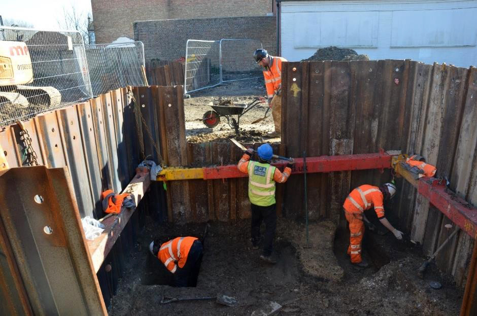
The nature of the site within a residential area brought specific challenges, which were dealt with effectively by PCA, with the assistance of the Construction Contract Manager at Norwich City Council, whose interest in the project aided its timely completion. The trenches were positioned with consideration for the various constraints typical of urban sites, while still targeting anomalies visible on the ground penetrating radar (GPR) survey.
Machine reduction at the site, and specialist shoring which was required within two of the trenches (due to the depth of the archaeological deposits) to allow their safe excavation, was provided by an external contractor.
There is some evidence for prehistoric activity in the area surrounding this site, and the adjacent street follows the course of a Roman road. However, Norwich as it is known and understood today, did not take shape until the Middle Saxon period; most of the evidence from the surrounding area available in the Norfolk Historic Environment Record is from the medieval and post-medieval periods. The majority of archaeological remains, comprising pitting, built structures, and surfaces discovered at this site can be dated to these later periods, with the exception of some lithics and residual human bone of indeterminate date. The human remains may indicate disturbed burials, possibly of prehistoric origin or from an earlier church’s burial ground.
Interestingly, despite the site being located within close proximity of Norwich Castle (and within the Medieval city walls), only limited evidence for Late Saxon to Early Medieval features were recorded. The finds and structures suggest an increase in activity in the Late Medieval and post-Medieval periods, indicating a pattern of limited occupation in this southern area of the city in the Early Medieval period, with increased urbanisation during the Late Medieval period.
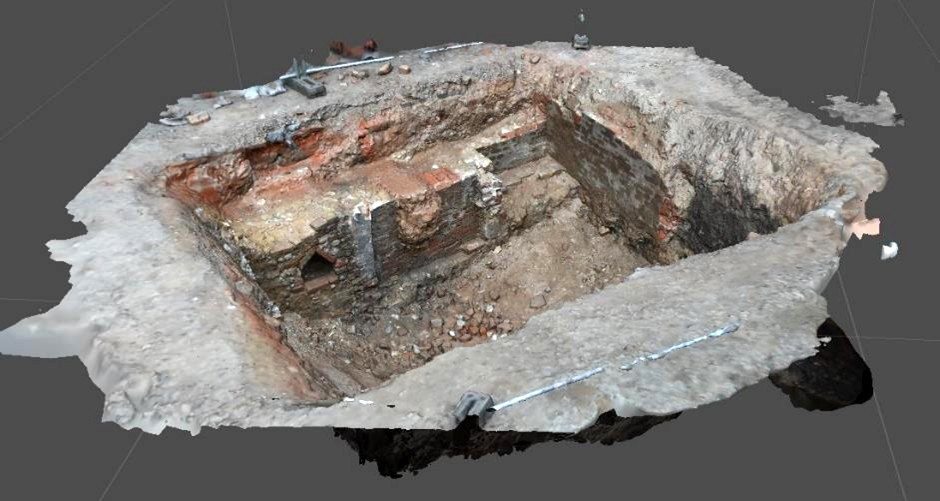
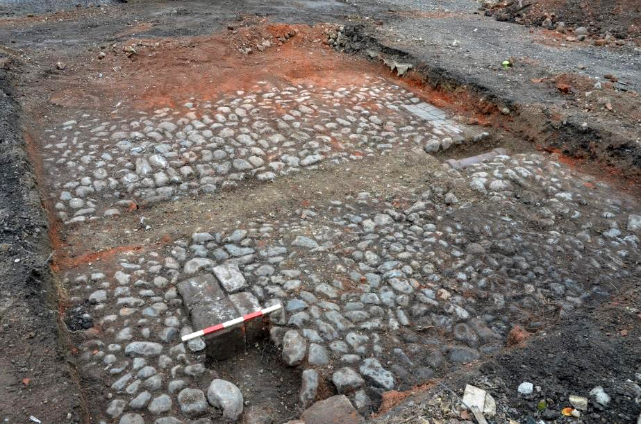
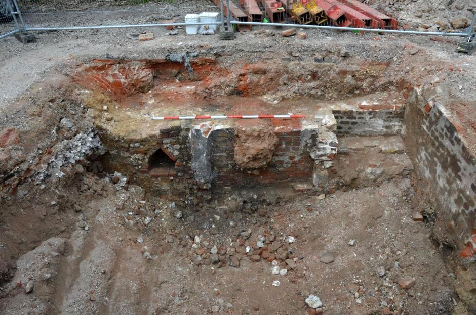
Structural elements observed during the trenching, such as basements, cobbled yard surfaces and walls (some with blocked up entrances), date to the Late and post-Medieval periods. Later medieval basements suggest a substantial building on the site and as such a level of prosperity; evidence for iron and bronze working on site, and a mercantile presence on the street indicate that the area was a hub of business activity.
The basements continued to be used into the post-Medieval period, with remodelling and rearranging of structures, associated with fewer artefactual remains. It is likely that the street frontage was occupied with buildings throughout the post-medieval period and Ordnance Survey maps show densely built areas with little change up to 1908. These were then cleared in the early 20th century, leaving the development area as a yard space. These excavations and analyses resulted in a site report, aiming to inform the design of an appropriate archaeological mitigation strategy to include further fieldwork in the form of targeted excavation areas. The archive, including interactive 3D models of the basement structures, will be deposited at Norfolk Museum Service, as will subsequent reports for the archaeological mitigations that will follow, and any additional reports in local or regionals journals that may follow.