Barmoor Castle Country Park
Berwick-upon-Tweed
Northumberland
TD15 2TR
United Kingdom
Map
Sorry, no records were found. Please adjust your search criteria and try again.
Sorry, unable to load the Maps API.
Description
PCA Durham were commissioned to undertake archaeological works in association with a proposed planning application for the most recent expansion proposal of the static caravan park at Barmoor Castle Country Park, Northumberland. This phase consists of the siting of 141 static holiday homes and their connected infrastructure on former agricultural land to the northwest of the existing caravan sites.
A Heritage Desk-based Assessment was produced by PCA in advance of the works that concluded that the site had low potential for Roman and early medieval remains and high potential for prehistoric, medieval and post-medieval activities.
The geophysical survey commissioned by PCA identified anomalies within the proposed development that were suggestive of prehistoric to Roman features.
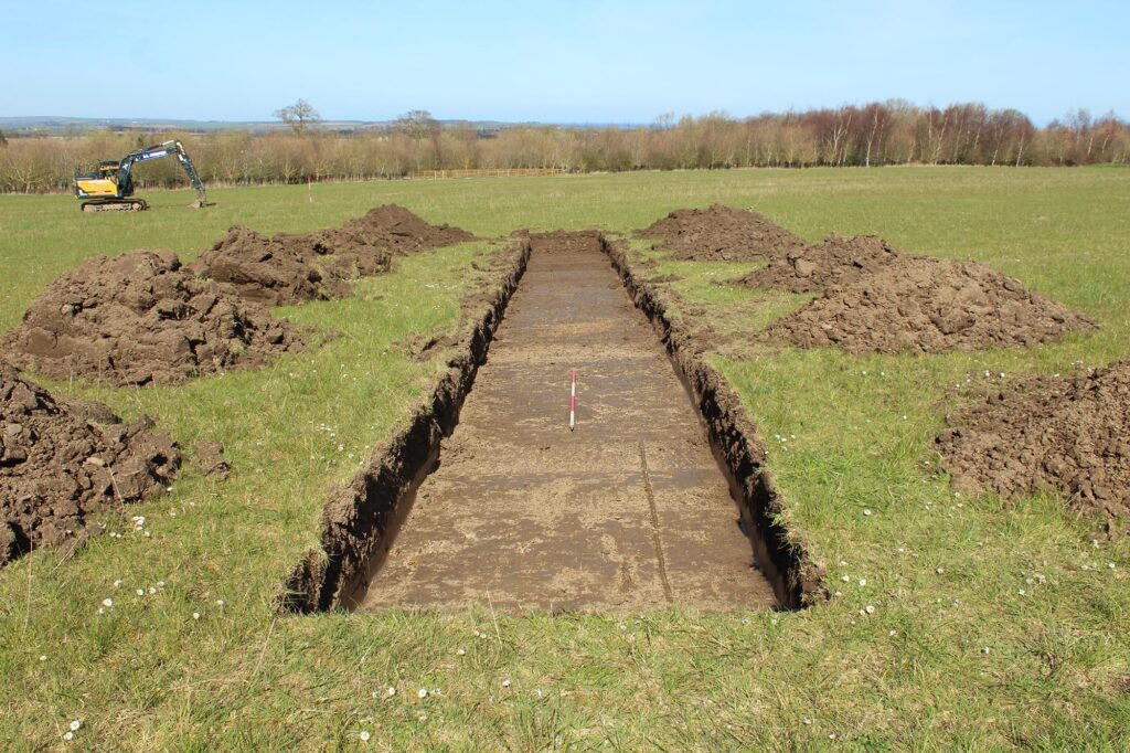
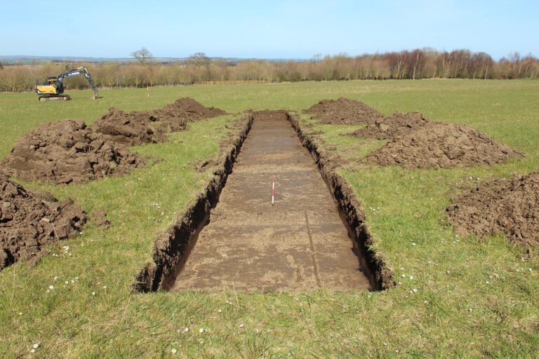
In accordance with PCA’s approved Written Scheme of Investigation a programme of trial trench evaluation, comprised of fourteen trenches located across the proposed development. The trenches were sited to investigate potential archaeological assets identified by the geophysical survey.
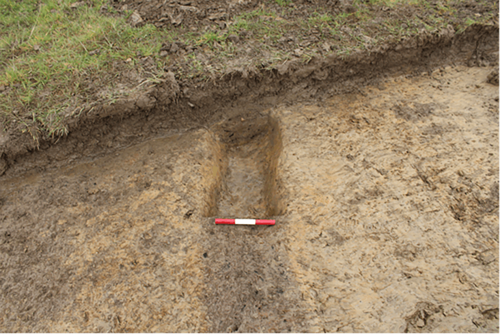
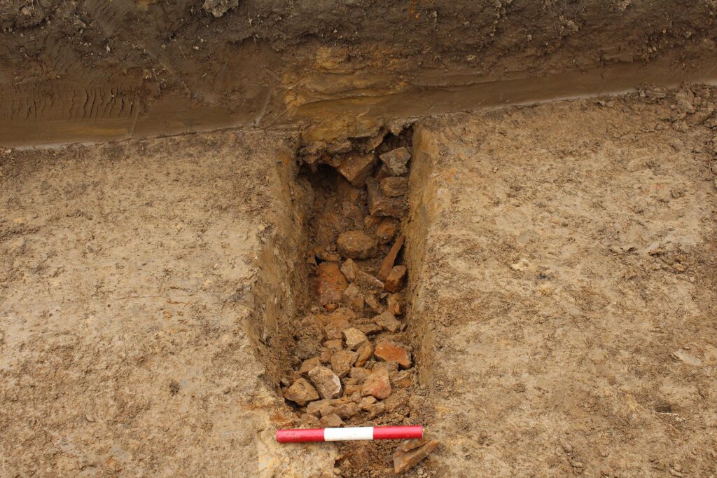
Six phases of activity were encountered at the site, the earliest being superficial geology comprised firm clay with bedrock partially exposed within five trenches. A colluvial subsoil sealed this which was cut through by a single undated gully. Although undated it predated the later, probable, medieval furrows. Environmental samples taken from the gully fill recovered charcoal from a variety of species, charred plant remains and a small quantity of bone and fired clay. Although no definitive dating was given to the gully the paleoenvironmental results provide evidence of a heathy grassland that is consistent with a late prehistoric and Romano-British date in this region.
Shallow furrows were identified in six of the trenches and are of probable medieval origin.
Three undated gullies corresponded to anomalies identified by the geophysical survey. No datable artefactual material was recovered from any of the gully fills and without a stratigraphic relationship these potentially are of any date between the prehistoric and modern eras. Covering all features and exposed colluvium was a half metre thick topsoil and turf.
A report has been generated detailing the results of the excavations to satisfy planning conditions.