Battersea Power Station
London
Greater London
SW11 8BU
United Kingdom
Map
Sorry, no records were found. Please adjust your search criteria and try again.
Sorry, unable to load the Maps API.
Description
The decommissioned Battersea Power Station site lay immediately to the south of the River Thames in an area of London settled from prehistoric times onwards. From the mid-19th century, the area became heavily industrialised, with the iconic power station being built in the 1930s. This was decommissioned in 1983, with much of the surrounding area becoming derelict wasteland. A multi-phase urban regeneration project covering nearly 17 hectares was launched in 2013.
The archaeological works consisted entirely of a series of Watching Briefs (monitoring and recording) on the various redevelopment areas. These works posed a series of logistical challenges, with safety always forming the priority. Working in close cooperation with site contractors and liaising with consultants and regulators allowed the maximum value to be derived from the investigations. The results provided a new and detailed understanding of the prehistory of the area.
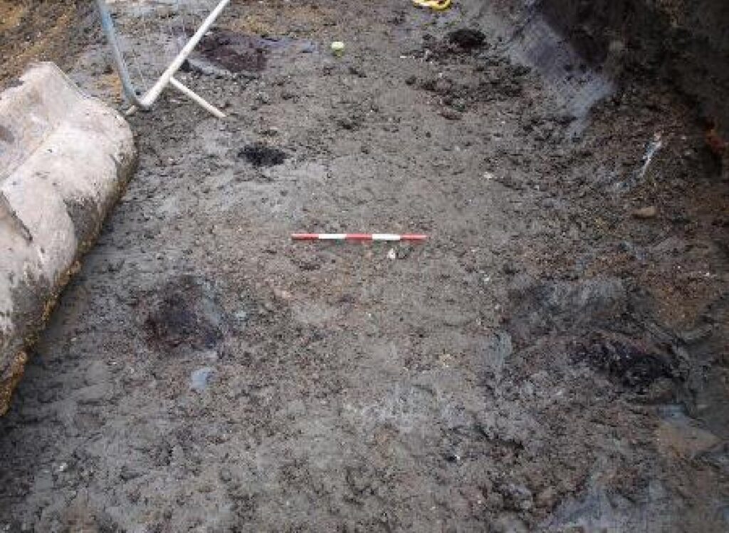
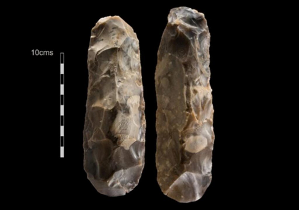
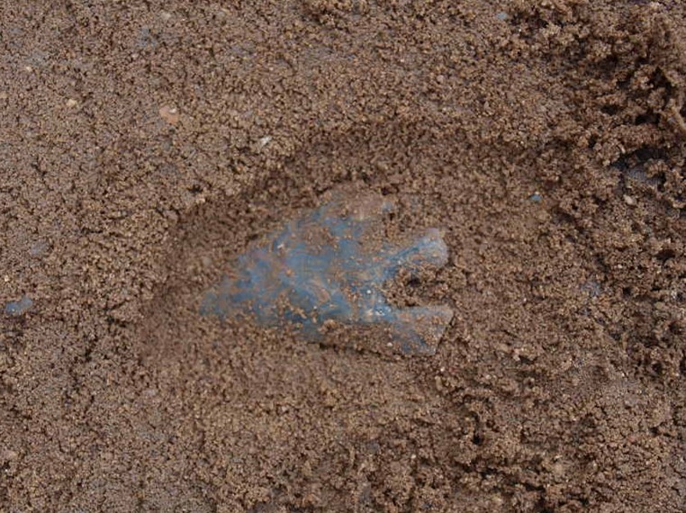
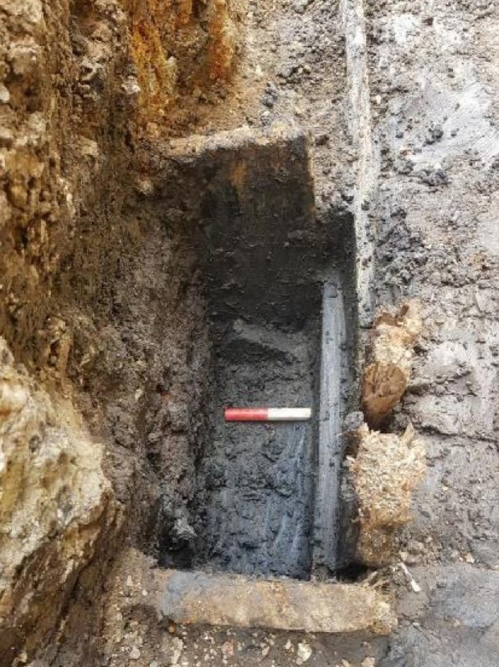
The archaeological monitoring revealed a continuous stratified sequence of archaeological deposits extending from the Mesolithic period (around 10,000 BC) to the present. Within naturally formed alluvial deposits was evidence of human exploitation, noticeably a cluster of timber piles, posts and postholes forming a possible crescent or circular structure up to 9m in diameter thought to be Mesolithic in date. On the high ground located to the southeast of the site this phase was categorised by the ritual deposition of two stone tranchet axes as well as possible evidence for occupation from this period.
After the deposition of the timbers the site reverted to a wetland marsh with additional phases of drying out and floodings. Within the final sequence of this phase an additional set of timber posts were recorded adjacent to the high ground within the basin thought to be Bronze Age in date. Marine transgression and regression phases continued into the late medieval period but no significant structural elements were evident.
During the late medieval or early post-medieval period drainage ditches were dug in an effort to drain the marsh.
A run of timber posts were identified, thought to be the remnants of a trackway which is visible on 18th-century maps. The presence of this raised trackway suggests the area was still waterlogged into the post-medieval period. In 1850 the Battersea and Southwark waterworks were constructed and elements of these were recorded across the site in the form of water tanks, inlets, soakaways and reservoirs. These were heavily truncated by modern construction works for the coal-powered power station and associated infrastructure in the 1930s.
Outreach during the excavations included participation in the Battersea Channel Forum, a regular meeting of specialists hosted by Historic England. The results of the various stages of work have been detailed in the relevant archaeological reports produced as part of the planning process.