Bloy’s Grove Solar Farm
Swainsthrorpe
Norfolk
United Kingdom
Map
Sorry, no records were found. Please adjust your search criteria and try again.
Sorry, unable to load the Maps API.
Description
PCA Norwich undertook a programme of archaeological trial trenching on land at Bloy’s Grove to assist in the discharge of an archaeological condition as part of the planning consent. The trenching scheme was devised by the client’s archaeological advisor in consultation with the Historic Environment Service of Norfolk County Council (HES/NCC).
Prior to excavations, a geophysical survey and a Desk-Based Assessment was compiled to ensure that trenches were located in the most logical locations, to target both expected archaeological and blank areas within the site. Previous excavations and find spots within the site’s immediate surrounding revealed activity from the early prehistoric through to post-medieval eras, suggesting the potential for multi-phase occupation on the site.
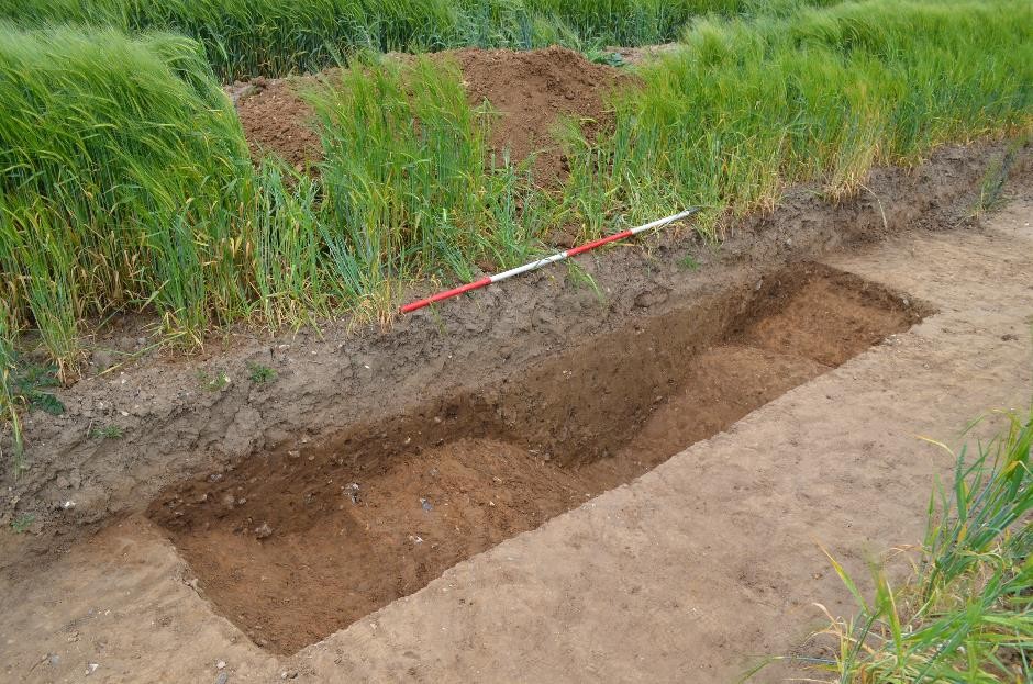
A total of 291, 50m long trenches, totalling 14,550m linear metres, were excavated across the 81ha site. A further four 10x10m contingency areas were also excavated, following intricate features being identified during the trial trenching, at the request of HES/NCC. A total of 151 trenches, containing archaeological features including Neolithic pits and ditches, a Late Bronze – Early Iron Age settlement, transitionary activity into the Roman period associated with the Roman Pye Road, the boundary of the deserted Medieval village of Kenningham, and further boundaries and pits associated with post-Medieval activity, were recorded during the works.
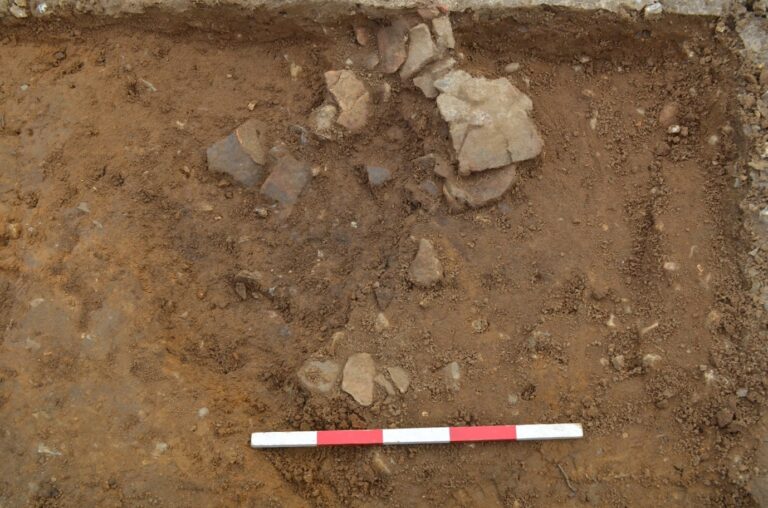
Contingency areas were excavated around an area of Neolithic pits where a concentration of struck flints were located within one trench, a greenstone axe head recovered from another and a layer of burnt flint in a third. With scatters of residual flint tools and debitage (waste flakes) across the rest of the site, it is likely that a flint working site and associated settlement is in the vicinity of the investigations. Middle Bronze Age dated activity, in the form of a boundary ditch, later reused during the Early Iron Age at the west of the site, enclosed settlement activity. Early Iron Age pottery was found in boundary ditches in the northeast corner of site that also contained early Roman pottery in its upper fills. Cropmarks beyond the boundary of site at both locations indicate denser settlement just beyond the boundaries of the site.
This trenching project has revealed significant results, with multi-period occupation evidenced across large areas of the site. The forthcoming report will comment on how these continued occupations can educate our understanding of previous land usages on comparable sites in East Anglia, adding evidence to key themes relating to settlement types and patterns throughout the past.