Chatham Waterfront, Kent
Chatham
Medway
ME4 4SL
United Kingdom

Map
Sorry, no records were found. Please adjust your search criteria and try again.
Sorry, unable to load the Maps API.
Description
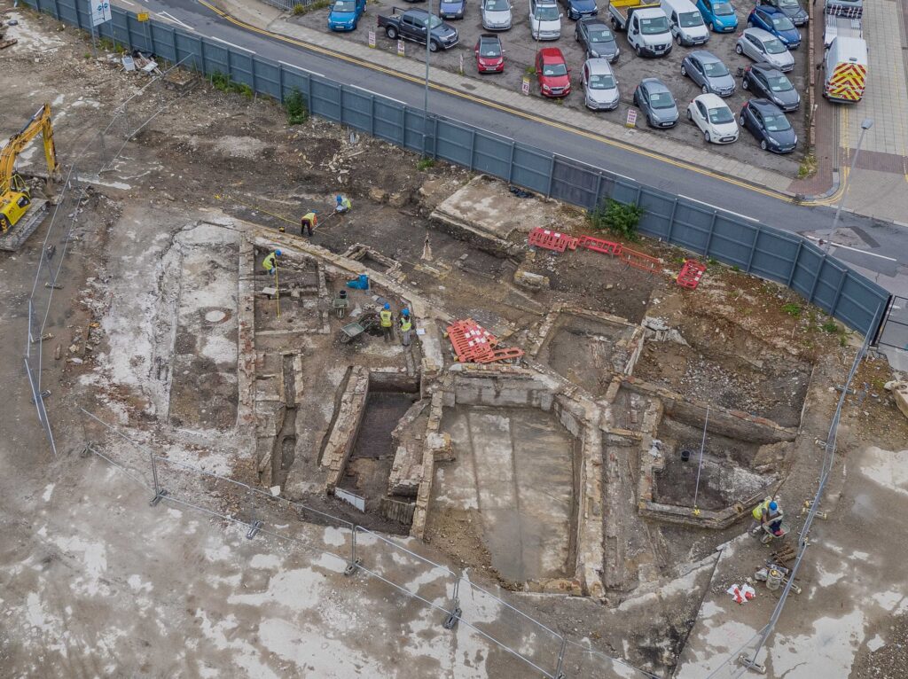
The site, which fronted onto the River Medway, was located on the north-western edge of Chatham town centre, in an area known to have been developed and occupied from the 18th century onwards, beside the Royal Naval Dockyard.
Archaeological works were initiated as an evaluation followed by open area excavation that covered a relatively small, targeted area central area of the development site. The remainder of the site, much of which had until recently been within the tidal range of the Medway, was covered by a watching brief (monitoring and recording).
The results of the excavation demonstrated that by the late 17th century the eastern part of the site had been reclaimed, and a river wall established. No buildings dating to this period were recorded but drainage features and cesspits that would have served buildings were present. Far more extensive building remains dating to the 18th century were recorded, particularly a well-preserved basement with a brick floor.
Structural remains were extensive but fragmentary due to later truncations and an extensive east-west aligned wall established a land division that continued into the 20th century.
The extensive watching brief west of the excavation revealed a sequence of northeast to southwest aligned timber waterfronts. The development of these post and plank revetment structures demonstrated the frequent and substantial advancement of the waterfront in the later part of the 18th century.
This area of the site had a completely different system of land division to that recorded in the main area of excavation. The land reclaimed as the shifting waterfront advanced to the northwest, later identified as Bessant’s Wharf, left an inlet on the river frontage across the north-eastern part of the site.
A large building consisting of several irregularly shaped rooms was established which can be related to the King’s Head public house, the structure of which survived into the 20th century.
A large brick-built cesspit was probably associated with the public house; the extensive finds group recovered from the backfill almost certainly derived from it.
The later 19th century saw the extension of the quayside in the northwest corner of the site and a timber pier was built in the northeast of the site using piling methods.
Public outreach during the excavations consisted of updates on social media. Following conclusion of the excavations, a report has been produced adding to the knowledge of the development of Chatham waterfront from the late 17th century to the present day.