Former RAF Kirton, Kirton Lindsey
Kirton in Lindsey
North Lincolnshire
DN21 4NS
United Kingdom
Map
Sorry, no records were found. Please adjust your search criteria and try again.
Sorry, unable to load the Maps API.
Description
The former airfield, RAF Kirton, is located approximately 29km north of Lincoln, 27km south of the Humber bridge and sits on a natural north-south aligned limestone ridge crossing most of the county. The current A15, following the line of the Roman Ermine Street flies approximately 1.75km east of the site and another Roman road lies immediately to the west.
A residential development of between 130 and 220 dwellings with access roads and provision of pumping station and substation, engineering, and ancillary works were proposed for the site.
RAF Kirton had its origins in the First World War and was greatly expanded in the Second World War, at which time Romano-British ceramics were found. For this reason, in advance of the new development, Pre-Construct Archaeology Ltd Newark were commissioned to undertake two phases of archaeological evaluation and wider excavation.
By the time of its decommission in 2013, RAF Kirton was a small town with buildings, roads and numerous underground structures and services which made geophysical survey impossible. The same structures and services could potentially be hazardous to archaeological personnel and for this reason, all PCA site staff are trained in the use of cable avoidance tools as well as in the identification of hazardous materials such as asbestos. Several trenches and excavation areas had to be moved or reduced in size due to the possibility of there being live services. Toolbox talks were given to staff on site regarding site specific hazards such as the identification of ordnance, but fortunately, none were found!
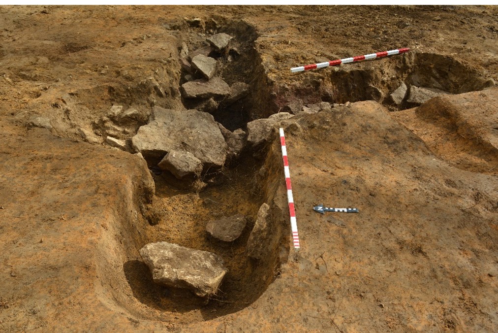
The first phase of evaluation comprised eighteen trenches that demonstrated a high degree of truncation from the expanded airfield construction but also identified several Roman ditches in the south-west of the site. These findings resulted in North Lincolnshire Council Historic Environment Officer requesting six additional evaluation trenches which further demonstrated the high degree of truncation.
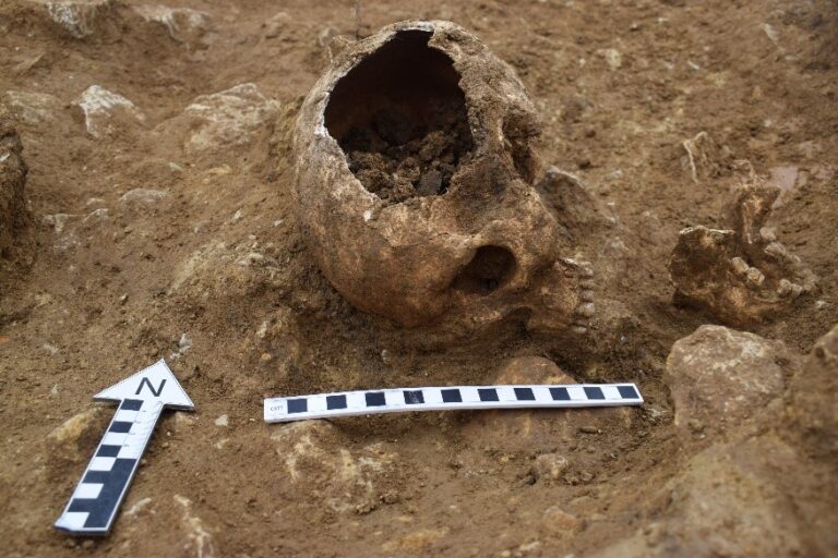
Several deep quarry pits were excavated that contained small quantities of 1st and 2nd century pottery, originally dug to exploit a ridge of natural limestone. Within the upper backfill of one of the quarries was the later interment of the skull and jaw of a young man. Radiocarbon (C14) dating of the skull produced a date range of AD 584-658, placing it within the Saxon period. The skull did not show any trauma relating to its death, and no other bones such as vertebrae were present to indicate it was a deliberate decapitation.
Elsewhere, 3rd-4th century rectilinear enclosure ditches were recorded: these enclosed the remnants of two probable corn driers, including one unusual one, shaped like an ‘X’.
On completion of the fieldwork a report was prepared for the client in support of their planning application and included artefact and ecofact analysis. Images of the site will be used for education and social outreach projects by the client and include PCA’s interactive 3D photogrammetry images of the skull and corn dryers.
The client’s Land Director said of PCA: I have to say that the PCA team have been professional, informative and courteous – a pleasure to meet.