Hawthorn Pit Solar Farm
Durham
County Durham
DH6 5NR
United Kingdom
Map
Sorry, no records were found. Please adjust your search criteria and try again.
Sorry, unable to load the Maps API.
Description
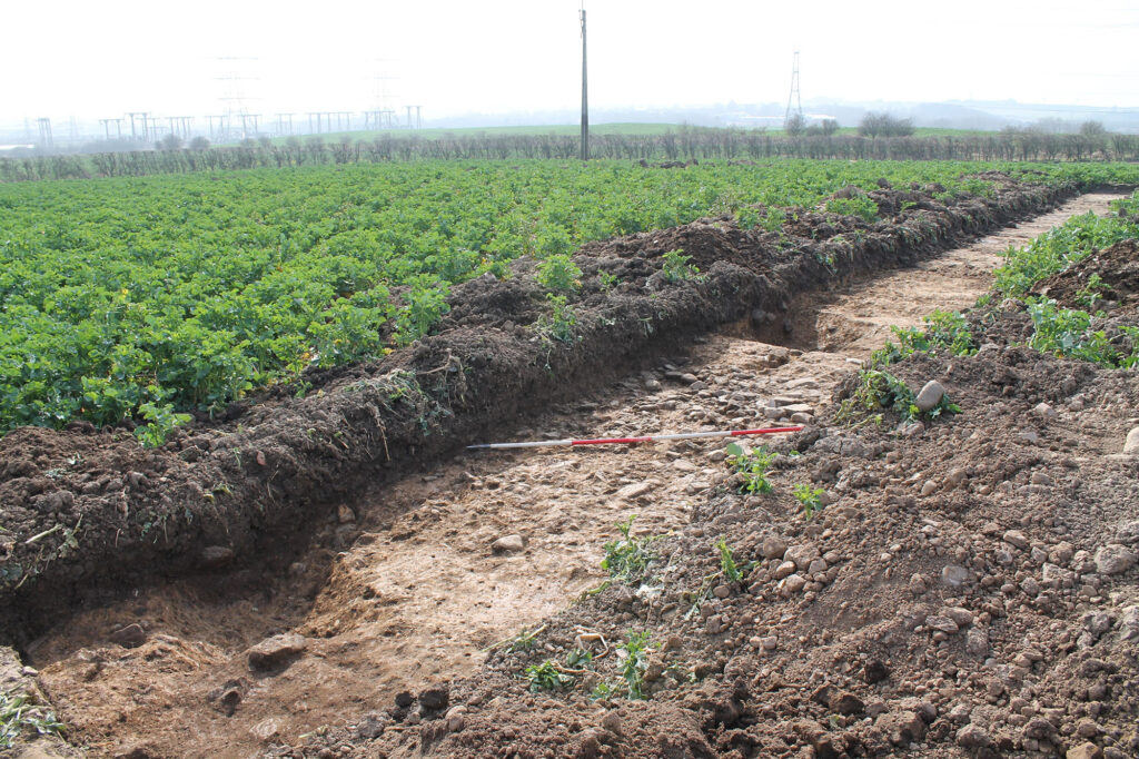
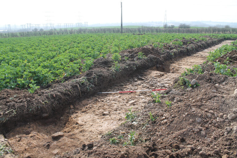
PCA Durham was commissioned to undertake an archaeological trial trench evaluation in connection with a proposed planning application for the installation of a ground mounted photovoltaic solar panel farm at Muton, Co Durham. The proposed development covered 52ha and comprised the installation of 93,132 solar panels together with 15 localised transformers.
A Heritage Desk-based Assessment was produced previously and concluded that the remains of prehistoric and Romano-British remains were present within the development boundary and therefore the potential for unknown archaeological remains of medium (regional) significance to be preserved within the site was assessed as high. A geophysical survey undertaken in 2020 established that anomalies within the western half of the site that may potentially date from the Bronze Age to post-medieval periods. These features included a round barrow, several enclosures and the probable line of a Roman road. There was very little apparent activity within the eastern half of the site.
As the area had been highlighted as having high archaeological potential, Durham County Council Archaeology team had advised that further archaeological work in the form of a trial trench evaluation was to be undertaken. The works were carried out according to a Written Scheme of Investigation prepared by PCA (2022) and approved by the council archaeologists prior to the commencement of evaluation. It had been agreed by the client and the council that a phased scheme of archaeological trial trench evaluation work was required for the pre-determination stage.
The initial phase of trial trenching involved investigated potential archaeological assets identified by the geophysical survey. Six phases of activity were encountered at the site, including a possible Iron Age sub-square enclosure, Roman features comprising ditches; postholes; gullies; a pit; and a road with roadside ditches, post-medieval features including agricultural drainage ditches and former field boundaries, several undated features and deposits that were located away from dated archaeological remains and could not be associated with any monument type and modern backfill of field boundaries and ploughsoil. A report on the findings was produced to satisfy planning conditions.