Horndean Care Village, Hampshire
Horndean
Hampshire
PO8 9NU
United Kingdom
Map
Sorry, no records were found. Please adjust your search criteria and try again.
Sorry, unable to load the Maps API.
Description
PCA Winchester was commissioned to carry out an archaeological evaluation and subsequent excavation at Horndean Care Village, Horndean, Hampshire. The site is the subject of a proposed development, for which planning consent has been granted by the Local Planning Authority.
The evaluation and excavation formed part of a staged approach to addressing the archaeological implications of the proposed development. The aim of the evaluation was to determine the presence or absence of archaeological deposits, identify their date, nature and preservation, and assess the significance and likely impact of the development on the buried resource.
The site lies c.160m to the east of Horndean, Hampshire and comprised an irregular parcel of land made up of paddocks, pasture and wooded areas. The site occupies a rural and elevated position in the landscape above Horndean village.
An archaeological desk-based assessment was undertaken to inform earlier planning proposals for the site and its setting and was augmented by a geophysical survey.
The site was identified as having a high potential for buried archaeological remains associated with Roman tile production, low to moderate potential for features related to Iron Age farming and for features related to post-medieval and modern activity.
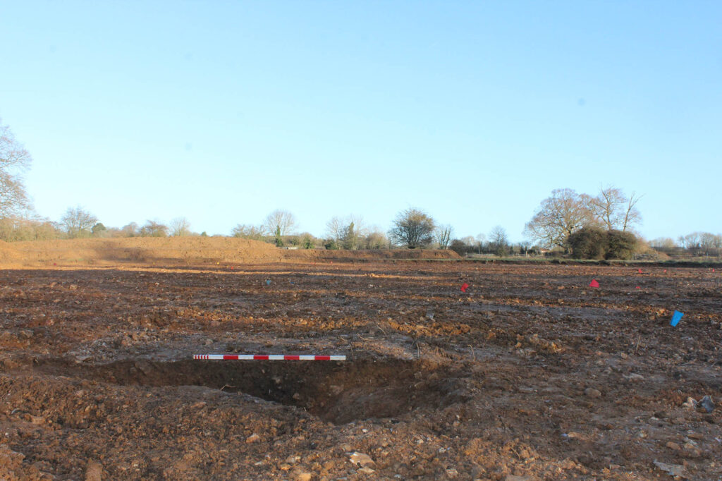
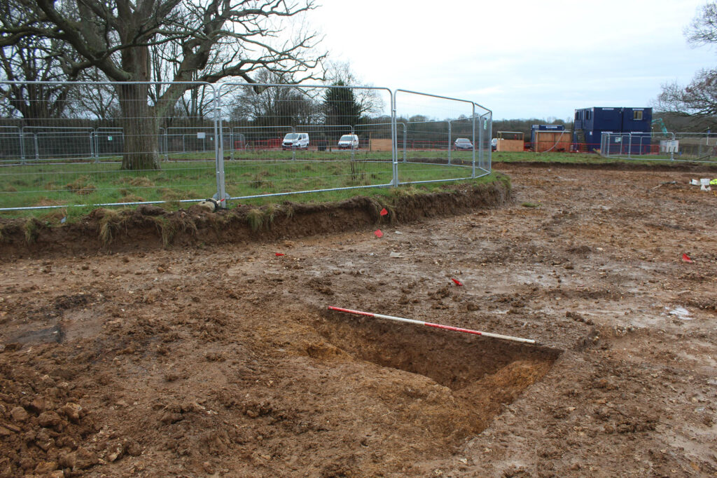
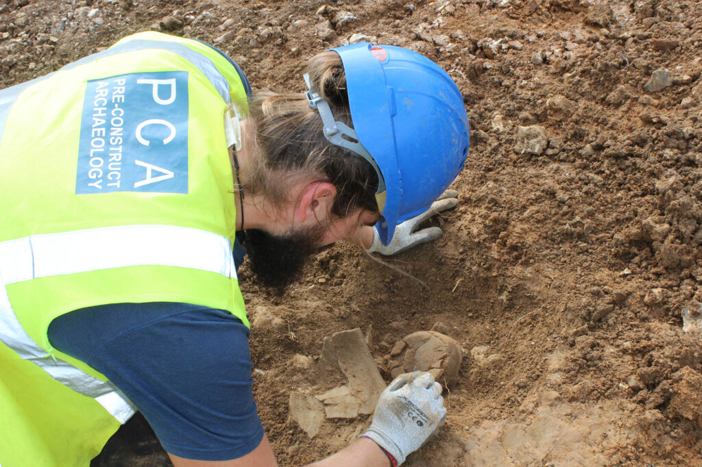
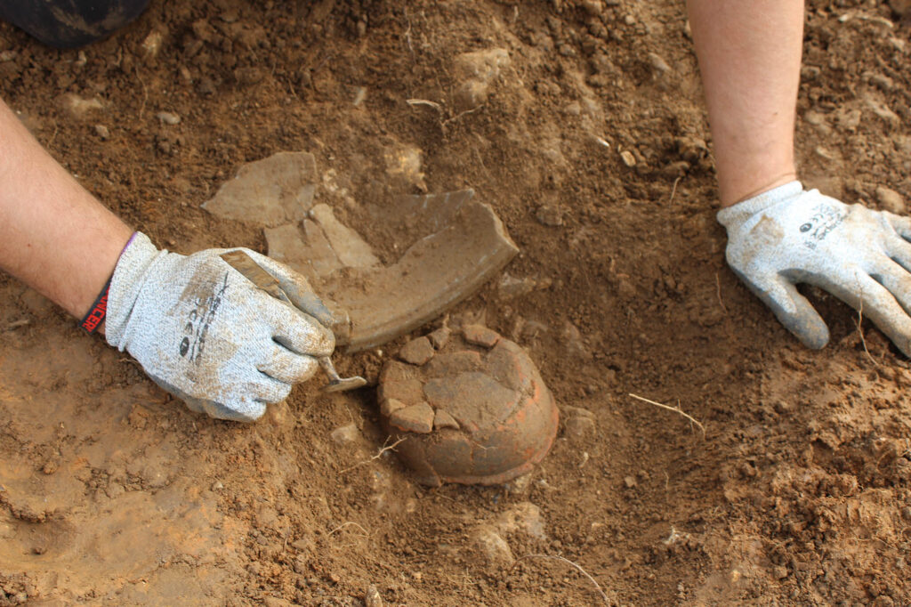
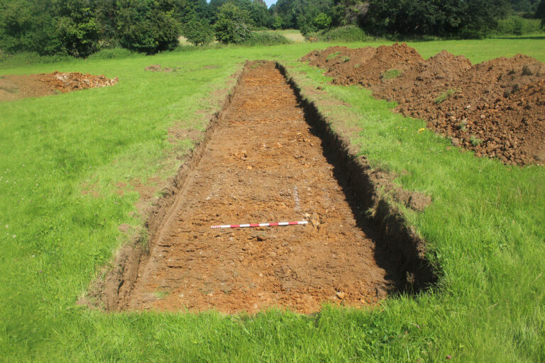
The archaeological evaluation comprised 39 trenches measuring 30m x 2m. The array of trenches sought to provide a sample of the site order to establish its archaeological potential. The evaluation revealed archaeological features, mainly focused on the centre of the site; nine linear intrusions and four small pits or postholes. Six of the nine linear features identified contained finds dated to the Late Iron Age/ Early Roman period, three of the four pits were also dated to this period by the finds. While the features do not indicate any readily identifiable site type, the relatively large quantities of pottery recovered suggests this activity is probably related to a small settlement or farmstead with field or enclosure boundaries, ditches, and pits.
The subsequent excavation comprised a strip and map exercise which succeeded in its primary aim of further contextualising the results of the archaeological evaluation and more accurately identifying and characterising the nature of archaeological activity on the site. The archaeological resources identified during the excavation are thought primarily to be related to agricultural activity during the Roman period, mid-1st–mid/late 2nd century AD. Evidence for Bronze Age activity was limited to three pits, the most significant of which contained worked flint thought to represent a single deposition event. No evidence of structures or other features related to settlement were uncovered. Both the Bronze Age and Roman remains are of local significance.
On the completion of both the evaluation and excavation, a post-excavation assessment report was written and is destined for publication in the peer reviewed journal ‘Hampshire Studies’ to comply with the planning conditions.