Lord Cranworth Farm
Grundisburgh
Suffolk
IP13 6RP
United Kingdom

Map
Sorry, no records were found. Please adjust your search criteria and try again.
Sorry, unable to load the Maps API.
Description
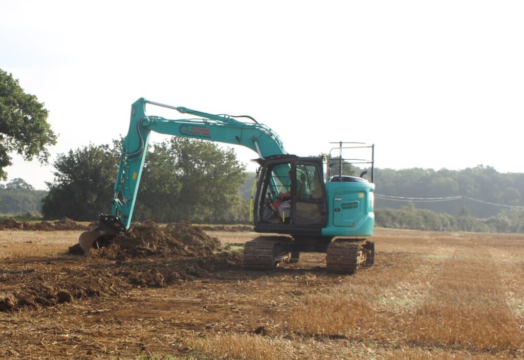
PCA Norwich were commissioned to undertake archaeological works at Lord Cranworth Farm in response to an archaeological condition attached to a planning application for the construction of a reservoir. In order to comply with the condition, a programme of trial trenching was proposed, in accordance with a Written Scheme of Investigation (WSI) prepared by, and actioned, by PCA Norwich.
A total of 1170 linear metres of trial trenching, comprising 39, 30m long trenches, were excavated, utilising and targeting information from a Desk Based Assessment (DBA) and Geophysical Survey previously commissioned on the site. Whilst minimal previous archaeological investigations had been conducted on the site, a Historic Environment Record (HER) search indicated activity spanning the early prehistoric through to the post-Medieval period, in the form of findspots for flints, bronze tools, pottery from various periods, bridle fittings, and coins, largely recovered from fieldwalking and metal detecting surveys. For later periods, Domesday book described two settlements of Culpho and Grundisburgh in the area, and field boundaries are visible on later Ordnance Survey maps. These boundaries and further ditches and furrows were visible in aerial photography and LiDAR imaging and represent previous field divisions prior to the creation of the larger modern field system visible during the present day.
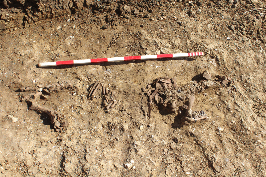
From the excavations, 20 out of the 39 trenches contained archaeological features or deposits. These mainly comprised ditches forming settlement boundaries and enclosures; a Late Bronze Age to Early Iron Age field system, the possible periphery of an Iron Age settlement, and a 13th to 14th century farmstead were all identified. Post-Medieval dated land divisions were visible across the area; one ditch was excavated by mechanical excavator and was cleaned and characterised by hand and the results indicated minor changes in agricultural use across the area over time. Pottery and lithic scatters assisted in dating a series of prehistoric ditches and pits, and suggested a similar early date for a large firepit which was located in their vicinity; this firepit was remained excavated during this phase of works with the agreement of Suffolk County Council’s Archaeological Service (SCCAS), as future mitigation in which a more complete analysis of the feature and its surrounding context can be undertaken.
The results from the trial trenching show good correlation with the geophysics and supports the pattern of activity expected from the DBA. Excavations were carried out by PCA efficiently and thoroughly, leading to a good understanding of the site and facilitated an understanding for targeted future works. The resulting report summarising the findings aims to inform the design of an appropriate archaeological mitigation strategy, with the site archive deposited with the SCCAS archives. Future works might potentially educate and bring clarity to the size and significance of the medieval settlement and activity that predated it.