Lound to Gorleston Water Pipeline
Gorleston
Norfolk
United Kingdom
Map
Sorry, no records were found. Please adjust your search criteria and try again.
Sorry, unable to load the Maps API.
Description
PCA Norwich was commissioned to undertake archaeological excavation for a largescale infrastructure project, the Lound to Gorleston Water Pipeline. The works comprised one 225m by 9m excavation area, and two areas of archaeological monitoring, approximately 413m in length, along a 2.5km pipeline easement in the parish of Belton and Browston in Norfolk. While infrastructure projects are not linked with planning applications, the archaeological works were commissioned in line with local authority best practice, as set out in the National Planning Policy Framework 2018, Section 16, ‘Conserving and enhancing the historic environment’, and under advice of the archaeological potential of the area from the Norfolk County Council Historic Environment Service (NCC/HES). The programme of works allowed for the assessment of a significant section of an extensive multi-period cropmark complex.
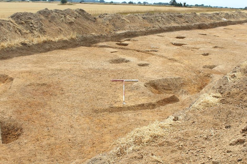
Following initial phases of archaeological monitoring and trial trench evaluation on the site, this stage of archaeological works identified extensive evidence on the line of the proposed pipeline. Potential archaeological activity was identified in the Historic Environment Record (HER) search of the site and its surrounding area; the majority of evidence leant towards a more widespread prehistoric activity, rather than Roman or Early Medieval, despite the presence of Browston deserted medieval village to the west of the site.
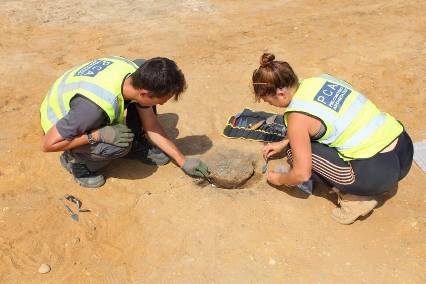
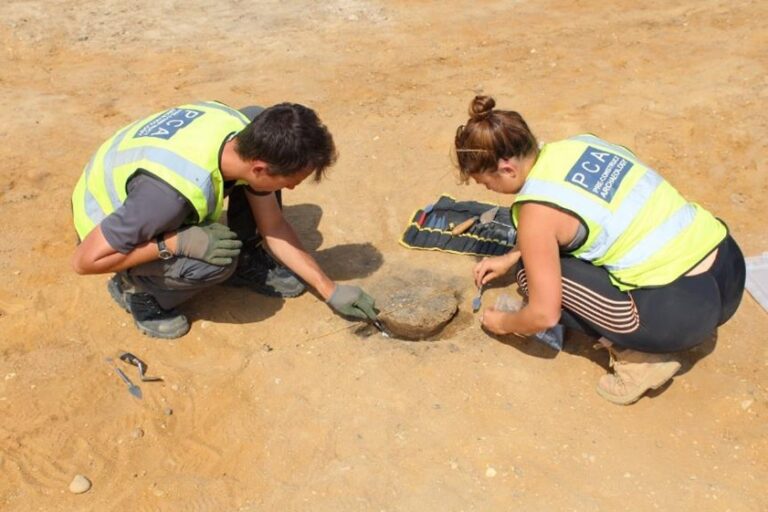
Undated archaeological activity observed during the initial trenching were clarified during this phase of works. The excavation and recording of three Early Bronze Age trackways along a northwest to southeast orientation, and one Late Bronze Age-Early Iron Age routeway roughly aligned north to south, occurred. The later trackway was observed on aerial photographs as extending for many hundreds of metres beyond the excavation area, perhaps servicing a settlement, as evidenced by a ring gully for a roundhouse and associated postholes, pits, and ditches. Three Middle Bronze Age cremations were also found, two adjacent to one of the trackways. Later activity, dating to the Roman period, was discovered in a localised area of site, where a large assemblage of Roman kitchen ceramic waste was found within a ditch fill.
The archaeological works conducted by PCA in the trial trenching, watching briefs, and open area excavation revealed an early date for many of the trackways and other features within this area, reflecting possible ritual and settlement activity spanning from the Early Bronze Age to Roman periods. The excavations will support future studies of the area, with the report describing findings, placing them in context, and assessing their significance against relevant regional research agendas. An article, to be published in the journal ‘Norfolk Archaeology’, will document proposed further works and research potentials.