Mardyke Estate (now Orchard Village)
Havering
Greater London
RM13 8FW
United Kingdom

Map
Sorry, no records were found. Please adjust your search criteria and try again.
Sorry, unable to load the Maps API.
Description
The Mardyke Estate was built in the 1960s by Ford to house workers at their Dagenham car plant and their families. The estate was redeveloped in phases over a period of 9 years as part of the London Riverside regeneration project within the Thames Gateway. The development site is now called Orchard Village.
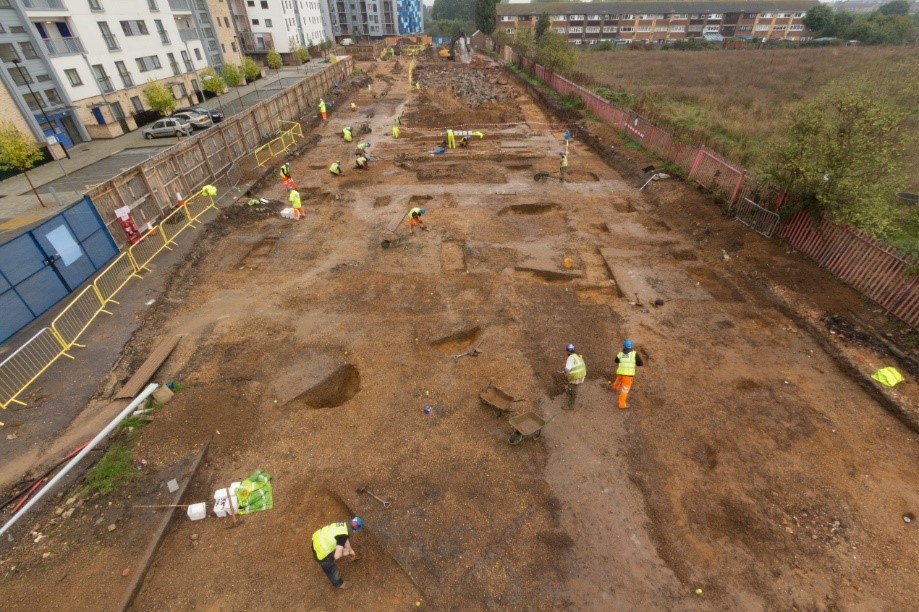
Pre-Construct Archaeology Ltd London was engaged to carry out archaeological investigations inn an area of known archaeological sensitivity. The site covered an area of over 5 hectares, and archaeological investigations took place in 6 separate areas across the site.
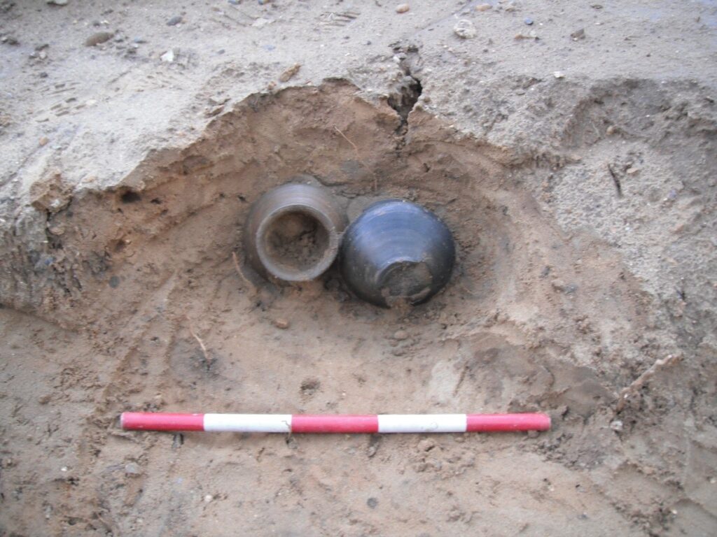
The earliest evidence for human activity on the site consisted of a single early Bronze Age burial. Despite the total absence of skeletal remains, the feature was interpreted as a burial predominantly because of the presence of a near complete decorated ceramic vessel, the form and decoration of which suggests that it falls within the later Beaker horizon, c. 2250-1950 BC.
Prehistoric activity continued on the site from the middle Bronze Age onwards into the early Iron Age as represented by a series of boundary ditches and pitting dated to the 10th-8th centuries BC.
There was little evidence for activity dating to the transition between the late Iron Age and early Romano British period, but in the late 1st to early 2nd century AD there was evidence for Roman occupation, as represented by field boundary ditches, pitting and multiple groups of ard marks, illustrating ploughing and early agriculture.
The second quarter of the 2nd century AD saw a dramatic increase of activity across the site with dense Roman settlement recorded consisting of enclosures and field systems.
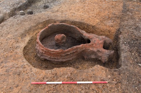
Roman pottery kilns which produced a local sand-tempered, coarse sand-tempered and shell-tempered wares were also recorded.
No Roman features or material culture after AD 200 was encountered suggesting that Roman occupation had ceased before the 3rd century AD.
Indeed, after the 2nd century there was little evidence of any activity at the site until the establishment of Mardyke Farm in the18th century, as illustrated on the first edition Ordnance Survey Map of 1867. Public outreach included a number of public talks and lectures and as well as a technical site report and a forthcoming academic monograph collecting together results across the area is being produced for publication. Three permanent information boards were also installed across the Orchard Village estate, detailing the archaeological remains found by period.