Royal Clarence Yard, Gosport
Gosport
Hampshire
PO12 1AX
United Kingdom

Map
Sorry, no records were found. Please adjust your search criteria and try again.
Sorry, unable to load the Maps API.
Description
The site, in Gosport on the western side of Portsmouth Harbour, had been associated with provisioning for the Royal Navy from the 17th century, and in 1827 was remodelled to the design of the Duke of Clarence, becoming the main site of the Royal Naval Victualling Board. It continued as such up to the First World War, when much of the naval supply operation was moved to Scapa Flow. It continued as a minor naval provisioning site until the late 20th century when it was decommissioned.
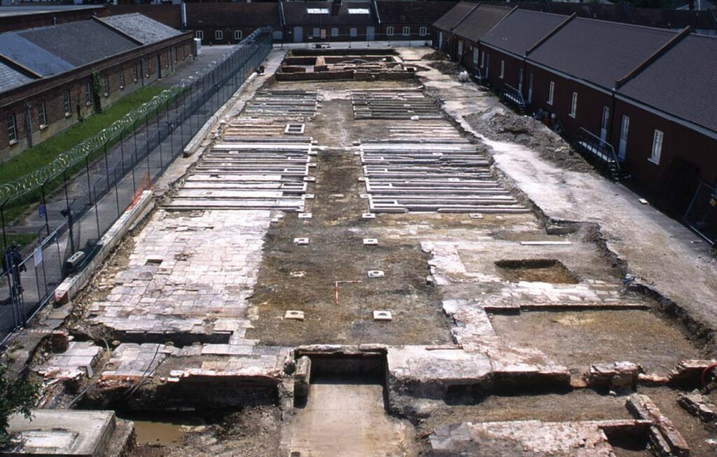
The project involved the demolition and redevelopment of the southern part of the yard, which occupied around 25 hectares, for residential apartments. The development was split into a number of phases, and Pre-Construct Archaeology London was commissioned to undertake archaeological investigations on a number of them.
Archaeological investigation in all areas was initiated by an evaluation, and where significant archaeological remains were present, this was followed by open area excavations, which took the form of ‘strip and map’ exercises.
The results of the investigations revealed the complex development of the site, starting in the late 1600s and continuing up to the eventual decommissioning of the naval facility in the 1990s.
Substantial structural remains were encountered indicating the presence of several phases of building in a good state of preservation.
Several phases of building relating to the storage of provisions for the Navy, particularly beer, from the earliest breweries established by Captain Henry Player at the end of the 17th century, were observed.
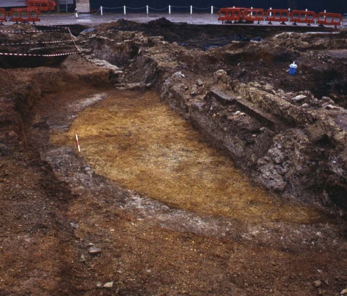
A somewhat mysterious building dating to the 17th century, marked by large circular foundations made of close-fitting stone blocks, was uncovered. The function of the building they supported remains unknown, although possibilities include a windmill, marked on some early maps of the area, or a large circular storehouse.
The results of the findings were detailed in several site reports, with the aim of an eventual publication.
Dominant amongst later foundations were those of a large storehouse that was built to represent a mirror image of the extant granary, mill and bakery complex that stands to the north. This was built upon land reclaimed from the sea and marked a period of increased importance and expansion of the site in the late 18th century as Gosport became a key provider of provisions for ships leaving Portsmouth.
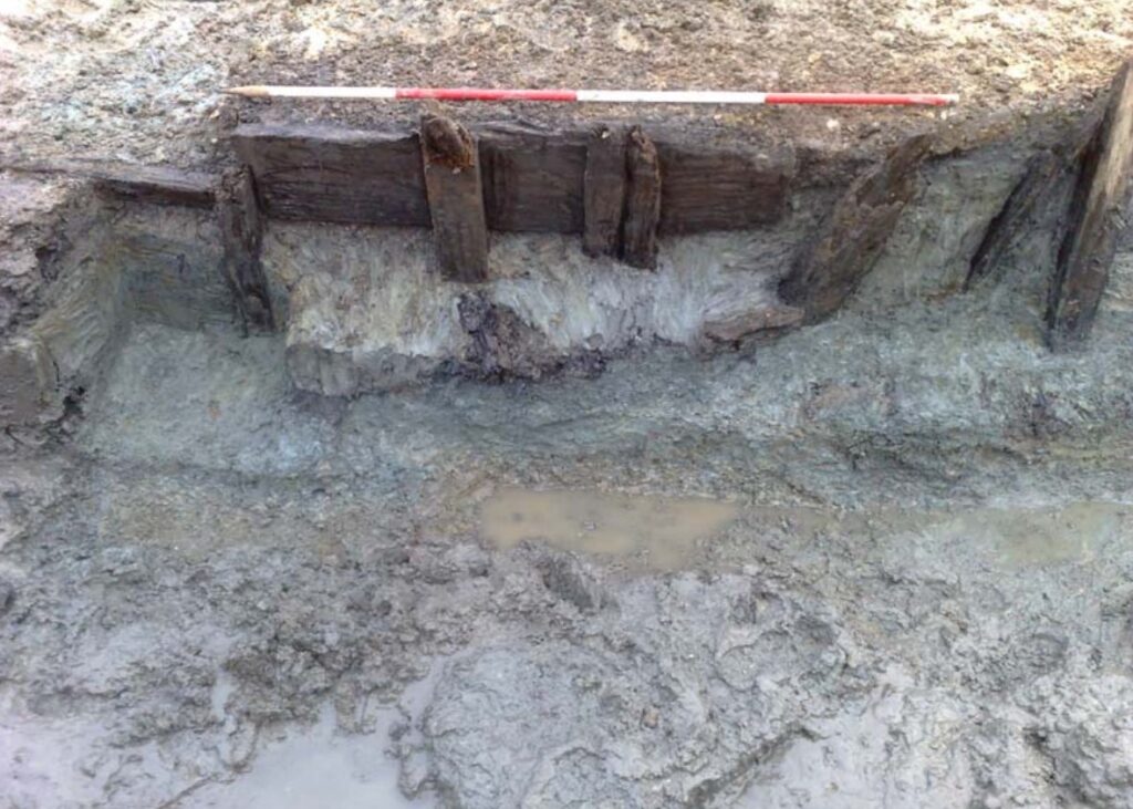
Reclaimed land was characterised by the mass dumping of thick blue clay, consolidated with timber revetments, masonry walls and ties. The extent of this reclamation was marked by a granite harbour wall that was in one of the trenches. The clay was also used to backfill a remarkably well preserved timber quay side structure dating from the mid-18th century. Associated with this were floors made from cobblestones and flagstones from a contemporary structure or yard.
The Luftwaffe bombing campaign of the Second World War caused considerable damage, with the destruction of a number of buildings and storehouses. In the 1960s, a new cold store building was constructed on the site for the storage of frozen goods for the navy. This was the latest structure to be uncovered on the site, having been demolished prior to the commencement of archaeological works.
Following conclusion of each phase of the archaeological investigations on the site, reports were produced setting out the detailed results, adding to the knowledge of the development of the site from the late 17th century to the present day.