Strategic Pipeline Alliance
Lincoln
Lincolnshire
United Kingdom
Map
Sorry, no records were found. Please adjust your search criteria and try again.
Sorry, unable to load the Maps API.
Description
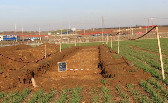
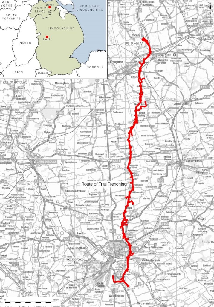
Anglian Water is creating a new drinking water grid for the East of England, which involves laying hundreds of kilometers of new pipes stretching from North Lincolnshire to Essex. The archaeological works are a collaborative effort between Pre-Construct Archaeology Ltd , York Archaeology Trust and Oxford Archaeology, PCA Newark was the lead in North Lincolnshire and Lincolnshire, on projects between an existing reservoir at Elsham, south to Waddington, skirting around the eastern fringes of the city of Lincoln, with a spur running to the south of Bracebridge Heath and terminating at Bracebridge Reservoir. Geophysical surveys were conducted in advance of intrusive works and trial trenching was selected as the most appropriate method to further characterize the archaeological resource. A total of 335 50m x 1.8m trenches were mechanically excavated along the 53km long and 40m wide proposed scheme.
The work took place in consultation with the Local Authority Archaeologists of Lincolnshire and North Lincolnshire and followed the methodologies set out in the Written Scheme of Investigation and Site Risk Assessment and Method Statement).
The northern 30km of the scheme was across lower ground with a geological bedrock of chalks, mudstone, siltstone, sandstone and clays with the remaining 20km through higher ground surrounding Lincoln with a limestone, sandstone, siltstone and mudstone geology.
The proposed scheme was to cross landscapes with potential to locate remains of prehistoric, Roman and Medieval date, the post-medieval activity related to existing settlements and 20th century airfields.
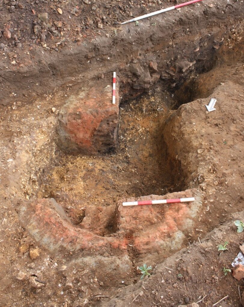
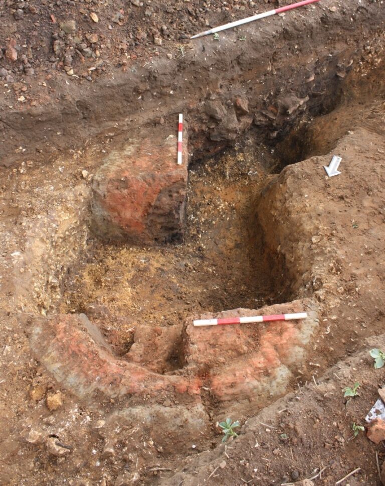
The work revealed three features of prehistoric date, five of Iron Age, 49 Romano-British features, three early- medieval and 53 dated medieval and post- medieval pits and ditches. Romano-British remains were located in three distinct concentrations; near Cotkills, where a 4th century pottery kiln was revealed, an Iron Age/ Roman settlement near Kettleby Beck and walls belonging to a Roman building near Waddington.
Further works have comprised of several excavation areas along the pipeline, and have varied in size, and duration. Since then, a programme of monitoring and geoarchaeological monitoring have been imposed at several locations.
Reporting is currently in its initial stages, and will be result in a publication.