Vulcan Wharf, Newham
Newham
Greater London
E15 2PW
United Kingdom
Map
Sorry, no records were found. Please adjust your search criteria and try again.
Sorry, unable to load the Maps API.
Description
The Vulcan Wharf project involved the demolition of existing industrial buildings and redevelopment of the site to provide residential units and employment space with associated landscaping.
PCA London was commissioned to undertake archaeological and geoarchaeological investigations on the site to discharge a planning condition. The site is located within a Tier III Archaeological Priority Area associated with the floodplain of the River Lea, which is an extensive area containing potential palaeo-environmental evidence for past wetland and riverine environments. It was also an extensive area of historic industry in the medieval and post-medieval periods.
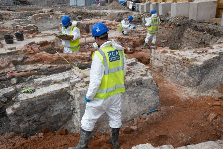
Archaeological investigations were carried out between April and June 2022, with an initial evaluation involving 6 trenches and, following demolition of the above ground structures, an open area excavation.
Due to its industrial background, the site environment posed a risk to excavation staff in terms of ground contaminants including arsenic, beryllium, lead, TPH, benzo (a) pyrene, and limited hydrocarbons. Ground gases identified comprised methane and carbon dioxide, and required careful advance planning to put in place safe working practices to mitigate any risk to the health of staff. PCA was able to use its experience and expertise to ensure a safe working environment. This included having clean and dirty welfare areas (with no dirty overalls/boots in clean areas), the wearing of steel toe-capped Wellington boots which were decontaminated at the end of the working day using a jetwash, wearing FFP3 masks (changed daily), disposable Type 5 overalls changed after each shift or at the end of the working day, eye protection, inner nitrile gloves and cut resistant outer gloves, both changed at the end of the working day. A 4-gas monitor lowered into the trench before staff entry. As the excavations took place during lock-down conditions associated with the Covid 19 pandemic, safety measures were put in place to ensure staff were protected from the risks of infections.
The archaeological investigations recorded a natural alluvial sequence, including localised peat, and industrial archaeological remains from the 19th century including the well preserved remains of a 19th-century lime works. Photogrammetry was used to accurately record features of interest so as to allow 3D modelling.
Following conclusion of the excavations, a detailed analysis of the archaeological features and finds and the environmental samples and geoarchaeological information was undertaken. This enabled a detailed picture to be built up of the prehistoric landscape of the site through to the beginnings of industrial development in the 19th century.
Public engagement relating to contaminated sites presents obvious challenges, but following completion of work on site, numerous of reports have been produced and lectures delivered to interested groups and societies.