Whinfield Solar Farm
Brafferton
England
DL1 3LE
United Kingdom
Map
Sorry, no records were found. Please adjust your search criteria and try again.
Sorry, unable to load the Maps API.
Description
PCA Durham were commissioned to undertake archaeological trial trench evaluation works in advance of the proposed construction of a solar farm. The site was located within an agricultural landscape centred on Whinfield Farm and comprises parts of nine mixed-use fields covering a total area of c. 34.2ha, of which 28.93 ha were suitable for trial trenching.
A Heritage Impact Assessment (HIA) completed in June 2021 assessed the archaeological potential of the site and informed the planning application of the proposed solar farm scheme. A geophysical survey detected anomalies considered to be agricultural in origin, including former field boundaries and ridge and furrow but also anomalies that could be derived from geological changes in the substrata. A series of linear and rectilinear anomalies were identified to the west and south of Whinfield Farm that were tentatively interpreted as belonging to a former field system or a series of enclosures.
Archaeological advice issued by DCCAS Historic Environment Record Officer, in September 2021 acknowledged that the results of the geophysical survey suggested that the archaeological potential of the site was generally low and requested a phased programme of post-determination works to confirm the potential for buried archaeological deposits, and, where identified, mitigate against their loss. A programme of archaeological trial trenching was therefore required to clarify the presence, nature, date, extent and significance of any archaeological remains that might be present within the proposed development area.
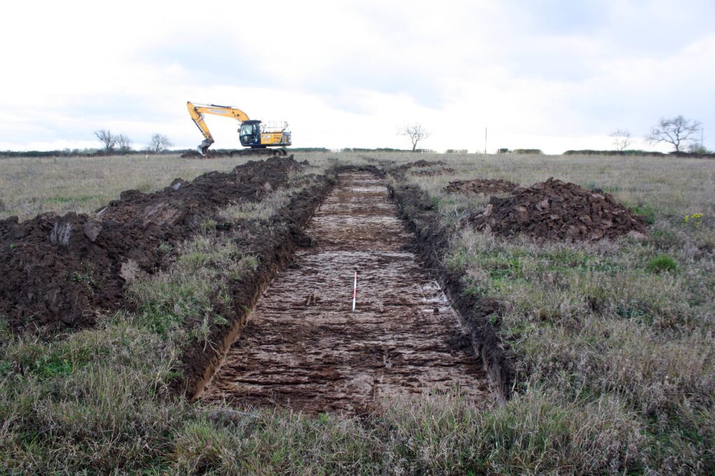
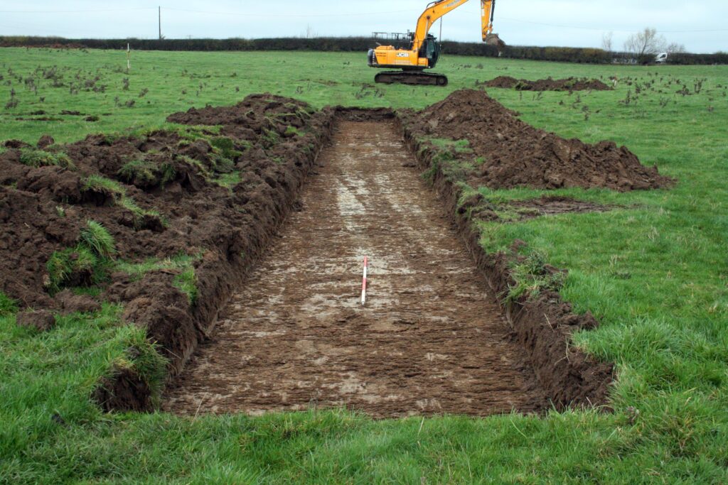
The archaeological evaluation works comprised the excavation of some 193 trenches spread across 13 fields, with each trench measuring 30m by 2m to target anomalies identified in an earlier phase of archaeological geophysical works as well as providing a wider sample of the site. The programme of trial trenching in total comprised a 4% sample of the proposed development area.
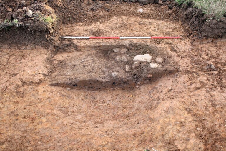
Four phases of activity were encountered comprising superficial geology, undated features and deposits, a post-medieval field boundary and modern plough soil.
Though undated, evidence from the environmental report suggests a post-medieval/modern origin of at least one of the pits the other pit and gullies are plausibly associated with post medieval agricultural activity.
There were a number of both above and below ground services known prior to start on site. ‘Goal-posts’ were employed to ensure plant could move safely below the overhead lines at pre- arranged access points. The evaluation was spread across a number of fields/areas which were mainly accessed easily from one field to the next, however a few of the areas were located on the opposite side of a road requiring transportation of plant by low loader.
The below ground services were located with the Cable Avoidance Tool as traversing through several of the planned trenches. Following liaison with both Lanpro and the Durham County Council Archaeology team slight adjustments to the trench locations were agreed so these could be safely excavated. A report has been produced detailing the results of the works to satisfy planning conditions.